




Dirt Tracks

وصف لـDirt Tracks
Dirt Tracks is a small and powerful application to keep track of your route while you make dirt biking and others. The quite complex functionality hides behind a very clear user interface which is easy to understand.
Dirt Tracks can be very useful for all of your off-road activities like dirt biking, hiking, motorcycle touring and driving fun.
Have a look at all of these fancy features:
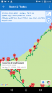
- Show current location of the phone on Google Map, if desired along with time, speed, altitude, duration and distance. even with latitude and longitude.
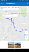
- Route recording, pausing, resuming, saving and listing.
- You can use whatever app you like to shoot the photos.
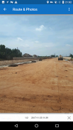
- Photos taken during a route are linked with this route and are shown together.
- Easy sharing of your routes together with photos using Facebook, VK, Line, Kakao, Wechat, etc.
- Markers can be inserted wherever you like. They can be shared together with a route.
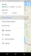
- 'Route Navigate' can calculate a route for your navigation to a marker or a given destination using these preconditions: car, bicycle or walking
- Voice announcement at predefined frequency of time or distance.
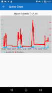
- A visual overview about speeds and altitudes of a route using fancy speed chart which can zoom.
- Stats can be done easily.
- Routes can be exported as GPX/KMZ files, also can be imported from your phone or Google Drive.
- Users can create a group or join a group to share routes with friends.
Important: Google Maps should be installed.
المسارات الترابية هو تطبيق صغير وقوي لتتبع مسارك في حين جعل لكم ركوب الدراجات الترابية وغيرها. وظائف معقدة جدا يخفي وراء واجهة المستخدم واضحة جدا والتي من السهل أن نفهم.
يمكن المسارات الترابية يكون مفيدا جدا لجميع الأنشطة على الطرق الوعرة لديك مثل ركوب الدراجات الترابية، والمشي، بجولة دراجة نارية ومتعة القيادة.
إلقاء نظرة على كل هذه الميزات الفاخرة:
- عرض الموقع الحالي من الهاتف على خريطة جوجل، وإذا رغبت في ذلك جنبا إلى جنب مع الوقت والسرعة والارتفاع، والمدة والمسافة. حتى مع خطوط الطول والعرض.
- الطريق تسجيل، والتوقف، استئناف، وتوفير والإدراج.
- يمكنك استخدام أي التطبيق الذي ترغب في اطلاق النار على الصور.
- ترتبط الصور التي التقطت خلال الطريق مع هذا الطريق وترد معا.
- تبادل سهل من الطرق الخاصة بك مع الصور باستخدام الفيسبوك، VK، الخط، Kakao، Wechat، الخ
- علامات يمكن إدراج أي مكان تريد. أنها يمكن أن تكون مشتركة مع الطريق.
- 'الطريق تنقل "يمكن حساب مسار للملاحة لعلامة أو جهة معينة باستخدام هذه الشروط: سيارة، دراجة أو المشي
- إعلان صوت في تردد محدد مسبقا من الوقت أو المسافة.
- لمحة بصرية عن سرعات وارتفاعات الطريق باستخدام سرعة الرسم البياني يتوهم التي يمكن تكبير.
- يمكن القيام به بسهولة الإحصائيات.
- يمكن تصديرها كملفات طرق GPX / KMZ، كما يمكن استيرادها من هاتفك أو في Google Drive.
- يمكن للمستخدمين إنشاء مجموعة أو الانضمام إلى مجموعة لتبادل الطرق مع الأصدقاء.
يجب تثبيت خرائط جوجل: الهامة.


